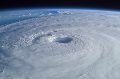
Researchers say a machine learning technique could help meteorologists provide more accurate medium-term forecasts and issue timely warnings to people who could be affected by these potentially deadly storms. Image: Wikimedia
Application of machine learning can optimize hurricane track forecast
Posted on August 4, 2020UNIVERSITY PARK, Pa. — When a hurricane approaches, providing a few extra hours’ notice can be the difference between life and death. Now, Penn State researchers report that applying a machine learning technique to a group of possible storm paths could help meteorologists provide more accurate medium-term forecasts and issue timely warnings to communities in the path of these potentially deadly storms.
In a study, the researchers used machine learning to remove certain groups of hurricane predictions from ensembles — sets of predictions from weather models that are based on a range of weather possibilities — to lower errors and improve forecasts four to six days ahead. Scientists use these ensemble models because weather is highly complex and trying to forecast even a single event creates huge amounts of data, said Jenni Evans, professor of meteorology and atmospheric science and director of the Institute for Computational and Data Sciences.
“The models are run slightly differently many, many times to create an ensemble of possible future states of the atmosphere. It’s this ensemble that is given to the forecasters,” said Evans. “We’re looking at 120 different forecasts at every time around the globe, then focusing on an individual typhoon or hurricane and asking, ‘What will this storm do in the future?’ Now, if you give those predictions to a forecaster only a few hours before their forecast goes live, that’s a huge amount of information to process. So, instead, we’ve used advanced statistics and machine learning to try to break down those 120 forecasts into between four and six clusters where each cluster represents a distinct prediction of the evolution of the storm from all of the other clusters.”
Weather watchers may better recognize these ensembles as the collection of squiggly lines that show possible storm paths during hurricane season.
Although these models are good and getting better, they are far from perfect, Evans said. Each prediction may account for a slight variation in the many variables that make up weather, such as energy from the ocean and clouds, she added. Also, they are mainly focusing on the sort of hurricanes — like Hurricane Sandy in 2012 and Hurricane Isaias in 2020 — that move up the coast and out of the tropics.
“But, when you are facing a hurricane, it’s important to know what type of storm you’re going to get — and when you’re going to get it.”
Jenni Evans
“These storms are generally more difficult to predict because their environment changes so much through their lifetime,” Evans said. “If you look at the current models, they’re imperfect because you can’t see every molecule of water that you would need and every piece of energy from the sun, and we also know that how we represent some of that information is imperfect. But, when you are facing a hurricane, it’s important to know what type of storm you’re going to get — and when you’re going to get it.”
Like an arborist who cuts away weak and damaged limbs so the rest of the tree can flourish, the researchers divided the ensemble into groups of forecasts, known as clusters, and “pruned” those that were expected to perform poorly, according to Alex Kowaleski, a postdoctoral scholar in meteorology and atmospheric science. The researchers found that very small clusters tended to perform much worse than other ones.
“There’s a strong relationship between cluster size and cluster error and it’s most prominent for the smallest clusters,” said Kowaleski. “The smallest clusters tend to perform much more poorly. That’s not due simply to it being a smaller ensemble size because, all things considered, if you just increase the ensemble size just by adding more members, you’ll get better performance up to a certain level. But these small clusters were so poor that they were doing worse than a randomly selected ensemble member.”
Among other results, the researchers, who report their findings in a recent issue of Weather and Forecasting, were able to reduce errors that could affect forecasts by removing these small clusters.
According to Kowaleski, while most people know that hurricanes are dangerous, they often do not consider that the storms’ hazards vary widely from place to place due to factors such as tides and local topography. However, clustering may help forecasters better predict the variety of scenarios in different locations along the storm’s path and get more precise warnings to people who may be unaware of the changing weather situation.
“A hurricane presents a massive area of hazards,” said Kowaleski. “If you’re a stakeholder or a person living on the coast, it doesn’t matter where the geographical center of the storm is and what the maximum wind speed is. What you ultimately care about is what are the severe conditions that you and your community is going to experience.”
The study includes over 120 forecast events taken from the North Atlantic, eastern North Pacific, central Pacific forecasts, western North Pacific storms, South Pacific and south Indian Oceans. The researchers obtained track forecasts for tropical cyclones that occurred during 2017 to 2018 from the THORPEX Interactive Grand Global Ensemble, or TIGGE. The TIGGE data employed in this study are provided by the European Centre for Medium-Range Weather Forecasts, the National Centers for Environmental Prediction’s (NCEP) Global Ensemble Forecast System, the UK Met Office Global Ensemble Prediction System and the Environment Canada Global Ensemble Prediction System.
Calculations for this study were conducted on the the Roar supercomputer.