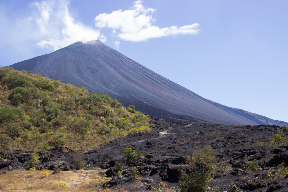
Scientists identified flank instability at Pacaya, an active volcano in Guatemala. IMAGE: KIRSTEN STEPHENS/PENN STATE
Scientists identify flank instability at a volcano with history of collapse
Posted on January 26, 2021UNIVERSITY PARK, Pa. — Landslides caused by the collapse of unstable volcanoes are one of the major dangers of volcanic eruptions. A method to detect long-term movements of these mountains using satellite images could help identify previously overlooked instability at some volcanoes, according to Penn State scientists.
“Whenever there is a large volcanic eruption, there is a chance that if a flank of the volcano is unstable there could be a collapse,” said Judit Gonzalez-Santana, a doctoral student in the Department of Geosciences. “To better explore this hazard, we applied an increasingly popular and more sensitive time-series method to look at these movements, or surface deformation, over longer time periods.”
Using the time-series technique, the scientists found surface deformation related to flank motion had occurred at Pacaya, an active volcano in Guatemala, from 2011 to 2013 when the volcano was largely quiet, and increased leading up to an eruption in 2014. Previous work had not identified flank motion during this time, the scientists said.
“People have looked at that volcano with satellite remote sensing but did not detect this long-term flank motion or creep,” said Christelle Wauthier, associate professor of geosciences. “Because the surface deformation changes are pretty small per year, it can easily be below the detection limits of conventional methods, but still within the limits of Judit’s work using a time-series approach.”
Scientists track surface deformation using radar satellites sensitive enough to spot changes of just a few inches on the ground. Comparing two of these images using the conventional Interferometric Synthetic Aperture Radar (InSAR) technique creates an interferogram, essentially a map of surface movement. But the quality of the InSAR results decreases with the time separating two images and can be affected by even small changes, like from vegetation growth or a buildup of ash spewed from a volcano, the scientists said.
The team instead conducted an InSAR time-series analysis using hundreds of satellite images taken over years and identifying surface deformation between each.
“You can use many of these short-term surface movement maps to give you information of surface displacement over a long time period,” Gonzalez-Santana said. “Then you can look at the surface deformation maps and see how much each pixel has been moving since the date the first image was acquired, for example.”
The results, published in the Journal of Volcanology and Geothermal Research, provide finer detail of volcanic flank motion, and can reveal upticks in the rate that creep is occurring, like at Pacaya before the eruption in 2014, the scientists said. The team has shared the results with officials in Guatemala who monitor the volcano.
“This kind of creep is not uncommon and not particularly dangerous on its own, but if you have extra forcings like from magma being pressurized and pushing against the wall of the chamber or intrusion, it can trigger a catastrophic collapse,” Wauthier said. “To be able to understand the behavior of the instability and potentially detect changes in rates of motion is very critical for monitoring that potential collapse.”
The method shows promise for identifying deformation particularly at volcanoes that lack expensive real-time monitoring networks and those located in tropical areas with thick vegetation that create problems for traditional InSAR, the scientists said.
Flank instability is often studied at oceanic volcanoes, where a collapse could trigger a deadly tsunami, according to the scientists. But collapses also happen inland, including prominently at Mount St. Helens in 1980.
Pacaya itself experienced a collapse sometime around 1,000 years ago, creating a debris avalanche that traveled more than 15 miles, and leaving a prominent scar on the volcano. Subsequent eruptions have built the volcano back up and it could someday again collapse, the scientists said.
“More than 10,000 people live within about three miles of the volcano,” Gonzalez-Santana said. “If you take into consideration the last avalanche traveled 15 miles away, anyone living in the valleys around the volcano could be at risk.”
A NASA Earth Surface and Interior grant, a Future Investigators in NASA Earth and Space Science and Technology grant, and an Institute for Computational and Data Sciences seed grant funded this research.
Share
Related Posts
- Careful analysis of volcano’s plumbing system may give tips on pending eruptions
- Wauthier awarded NSF CAREER award to investigate volcanic flank instability
- Deep learning artificial intelligence keeps an eye on volcano movements
- Seed Grants intended to plant success for interdisciplinary research projects